Geography and transportation
Lincoln Heights
Los Angeles Times
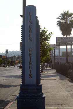
Lincoln Heights is bounded by the Los Angeles River on the west, the San Bernardino Freeway (I-10) on the south, and Indiana Street on the east; the district's Eastern border is unclear due to the area's uneven terrain. Adjacent communities include El Sereno on the east, City Terrace on the southeast, Boyle Heights on the south, Chinatown and Solano Canyon on the west, Cypress Park on the northwest, Mt. Washington on the north, and Montecito Heights on the northeast. Major thoroughfares include Valley Boulevard; Mission Road; Pasadena Avenue; North Main, Marengo, Daly, and Figueroa Streets; and North Broadway. The Golden State Freeway (I-5) runs through the district, and the Metro Gold Line has a stop in the far northwestern portion of the district. Lincoln Heights' ZIP code is 90031.
Lincoln Heights
Los Angeles Times
Lincoln Heights is bounded by the Los Angeles River on the west, the San Bernardino Freeway (I-10) on the south, and Indiana Street on the east; the district's Eastern border is unclear due to the area's uneven terrain. Adjacent communities include El Sereno on the east, City Terrace on the southeast, Boyle Heights on the south, Chinatown and Solano Canyon on the west, Cypress Park on the northwest, Mt. Washington on the north, and Montecito Heights on the northeast. Major thoroughfares include Valley Boulevard; Mission Road; Pasadena Avenue; North Main, Marengo, Daly, and Figueroa Streets; and North Broadway. The Golden State Freeway (I-5) runs through the district, and the Metro Gold Line has a stop in the far northwestern portion of the district. Lincoln Heights' ZIP code is 90031.
